Analysis of C-Band 5.305 to 5.505 GHz emissions near Sevastopol Crimea, Ukraine on 2023-11-23 and 24.
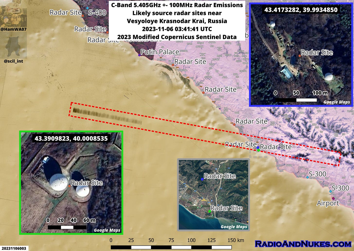
C-Band 5.405GHz +- 100 MHz Emissions likely originating from a radar site near Vesyoloye Krasnodar Krai, Russia.
@scil_int pointed out these pulsed emissions over the eastern Black Sea. If we extrapolate the line to the coast, it passes right over two known radar sites.
Without more data we can’t say with 100% confidence that these domes are the source of the emissions, however it’s likely that these are the source due to alignment of the signal to the sites.
SAR Image: Modified Copernicus Sentinel data 2023/Sentinel Hub
Sat Imagery: Google Earth
Date/Time: 2023-11-06 03:41:41 UTC
Source 1 Blue: 43.4173282, 39.9934850
Source 2 Green: 43.3909823, 40.0008535
Russian S-300 site near Kurbatskii, Krasnodar Krai 2023-10-22.
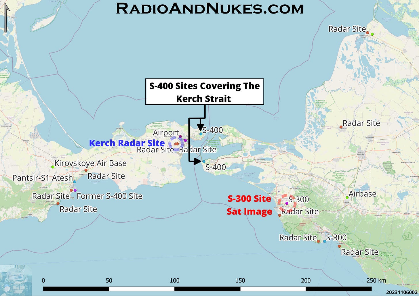
This site provides overlapping coverage of the Kerch Strait combined with S-400 sites on each end of the Kerch Bridge. The large Radio Engineering (Radar) Site west of Kerch houses multiple early warning radar systems that can cue the launch sites 96L6 acquisition and 92N6 engagement radars. We also know of multiple SHORAD systems, mostly Pantsir providing point defense.
The following equipment is visible at this site.
1 x 92N6 X-Band engagement radar
1 x 96L6 S-Band acquisition radar
5 x TELs likely of the 5P85 series 20 missiles in the launch position
2 x 40V6 mast groups not in use (can be used to elevate the 92N6 and 96L6 radars for better low-level coverage)
Misc support equipment power generators, mains converters, etc.
I have included a line-of-sight coverage plot of the 92N6 at this site.
Note: This is purely a LOS plot it does not account for propagation or radar performance characteristics.
Sat Image: © 2023 CNES AIRBUSDS
Date / Time: 2023-10-22 0821 UTC
Location: 44.9220365, 37.4192148 Near Kurbatskii Курбацкий, Krasnodar Krai Russia Overview Map: Open Street Map / RadioAndNukes DB
Coverage Plot: Cambridge Pixel Software
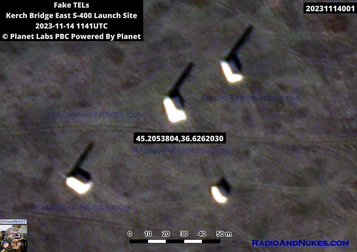
FAKE S-400 TELs at the East end of the Kerch Bridge!
This is a fun one, we have what appears to be 3x fake TELs painted bright white (85% confidence). I suspect the white paint might be an attempt to throw off the dynamic range of the satellite image making it hard to identify as fake (50% confidence!) This is not the first time we have seen these, but it is the first time I have caught them on a publishable image. The pass cut off the area with where the real TELs were in previous images. It’s possible the real site is operational I have no info to assess that at this time.
I have attached my overview map showing the location of the fake TELs and the second S-400 launch site on the west side of the Kerch Bridge.
Sat Image: © 2023 Planet Labs PBC Powered by Planet
Location: 45.2053804, 36.6262030
Time/Date 2023-11-14 1141UTC.
Image ID: 20231114001
Overview Map: Google Maps / RadioAndNukes DB
Image ID: 20231114002
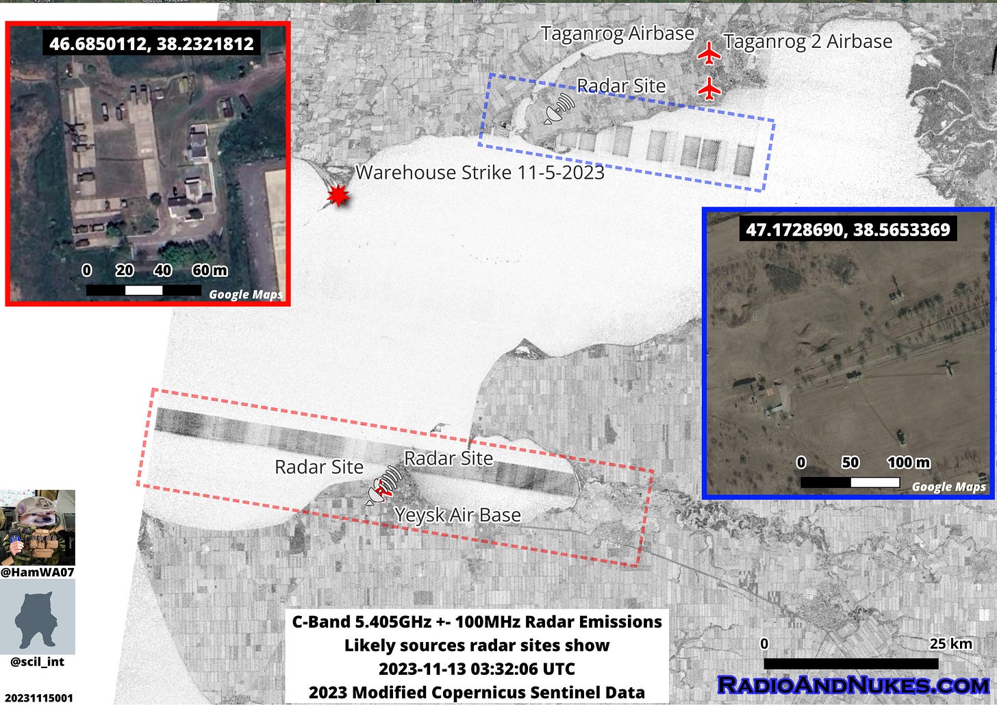
C-Band 5.405GHz +- 100MHz Emissions in the Azov Sea.
Thanks to @scil_int for pointing out these emissions likely originating from the radar sites near Yeysk Airbase and 23km WSW of Taganrog Airbase.
It’s still unknown which systems are causing this interference or even if it’s the fundamental frequency or a harmonic from 2700MHz S-Band systems. We are still researching this, if anyone has information of which system operates in the 5300-5500MHz range please contact me. Specifically, the 96L6 some sources say C-Band others say S-Band it’s split, Western sources seem to say C-Band while Russian sources state C for “Centimetric”! It gets more fun when Cyrillic C = English S
Sat Image: Modified Copernicus Sentinel data 2023/Sentinel Hub
Location: 46.950, 38.255
Time/Date 2023-11-13 03:32:06 UTC
Overview Map: Google Maps / RadioAndNukes DB
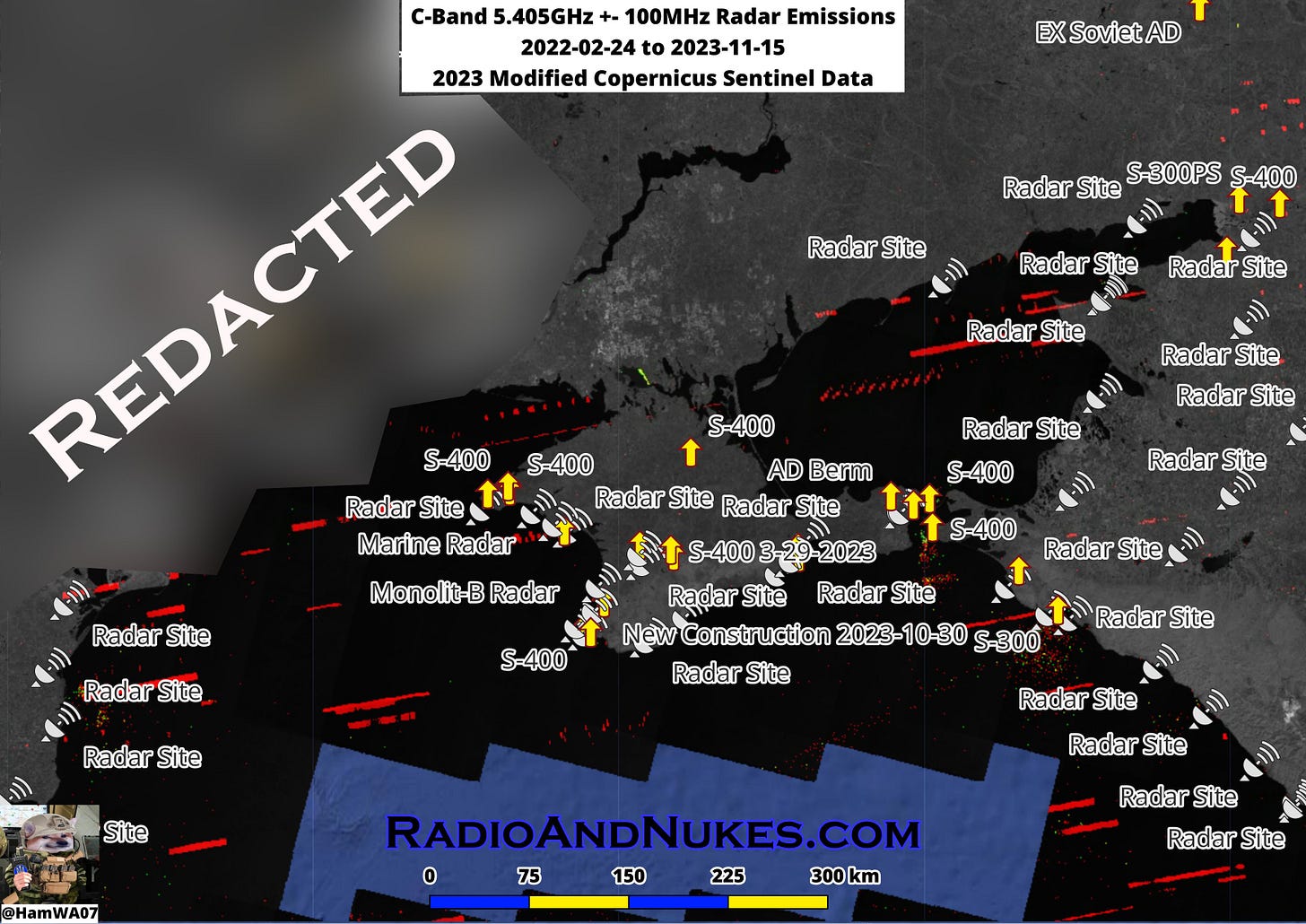
All of the C-Band 5.405 GHz +- 100 MHz since 2023-02-24 across The Black Sea with the known sites overlaid on top.
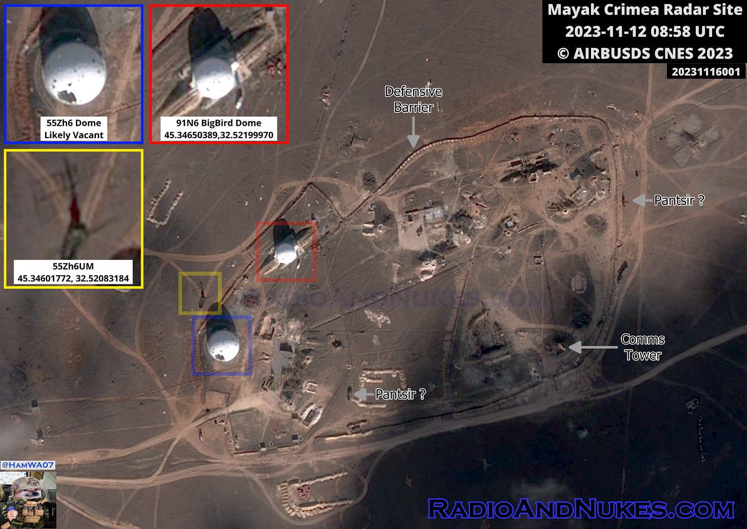
Mayak Crimea Radar Site 11-12-2023
It was time to have a return look at Mayak. The biggest changes are the increased defensive barriers. It appears the large NEBO-M dome built to house the VHF 55Zh6UM is likely vacant as we can see a 55Zh6UM outside just NW of the dome. The dome was damaged in a Ukrainian strike roughly in May 2023. It’s unknow what the stats of the 91N6 Big Bird dome is currently. We can see what looks like two Pantsir AD systems providing point defense for the site 50% confidence.
Image 1: ©CNES 2023, Distribution AIRBUSDS
Date/Time: 2023-11-12 0858 UTC
Location: 45.3458994, 32.5237681
Image ID: 20231112001
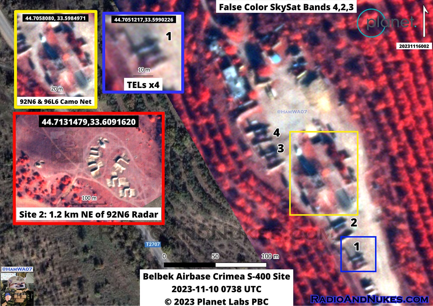
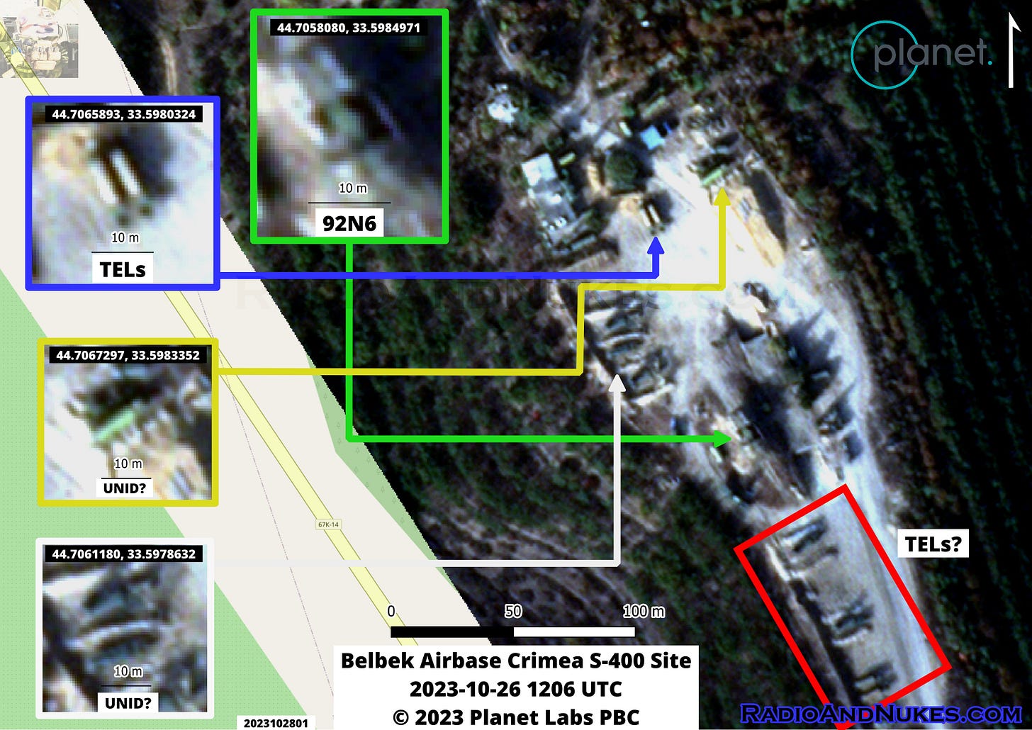
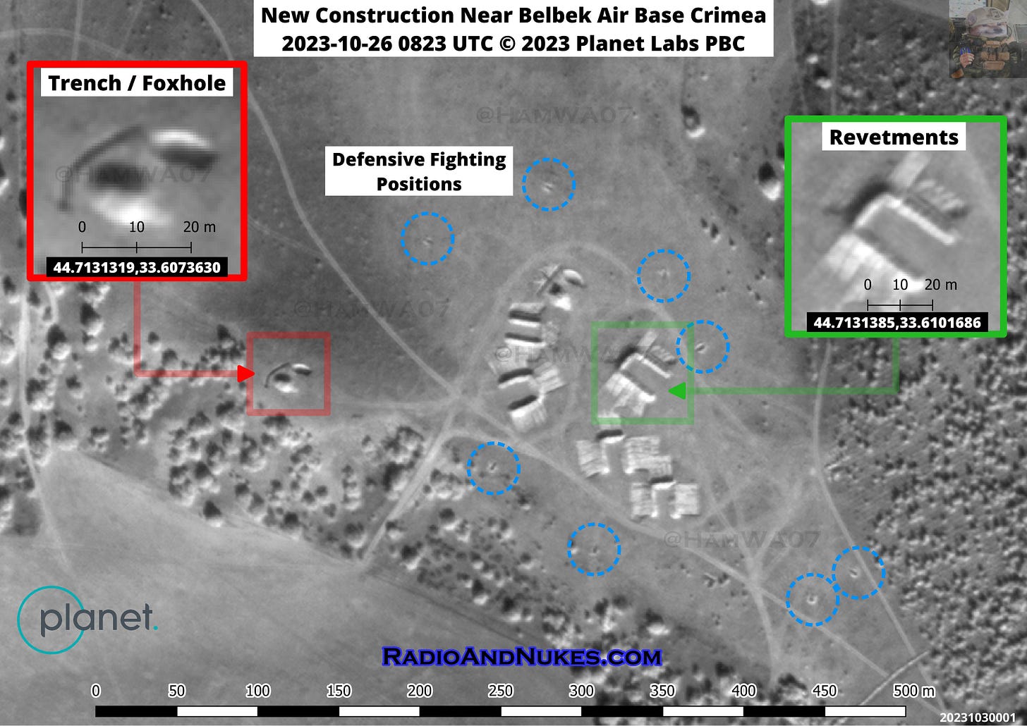
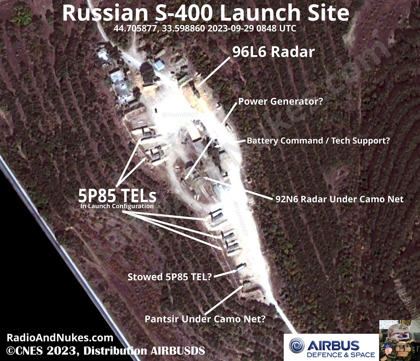
Belbek Airbase S-400 Site and the new site 1.2KM NE.
Had a quick look at the Belbek Airbase, Crimea S-400 launch sites. It looks like not much has changed at the main site. The 92N6 and 96L6 radars are covered with a camo net and the TELs are well dug in with defensive berms around them.
What I’m calling Belbek S-400 Site 2 is 1.2 km NE of the 92N6’s antenna. Site 2 has housed both active TELs and decoy TELs in the past. It looks to be empty in this image.
Notable equipment onsite:
1 x 92N6 X-Band engagement radar
1 x 96L6 S-Band acquisition radar
~4 x 5P85 series TELs of the S-300/400 system
Sat Image: © 2023 Planet Labs PBC Powered by Planet
Site 1: 44.7059250,33.5984640
Site 2: 44.7131355,33.6096724
Time/Date 2023-11-10 0738 UTC
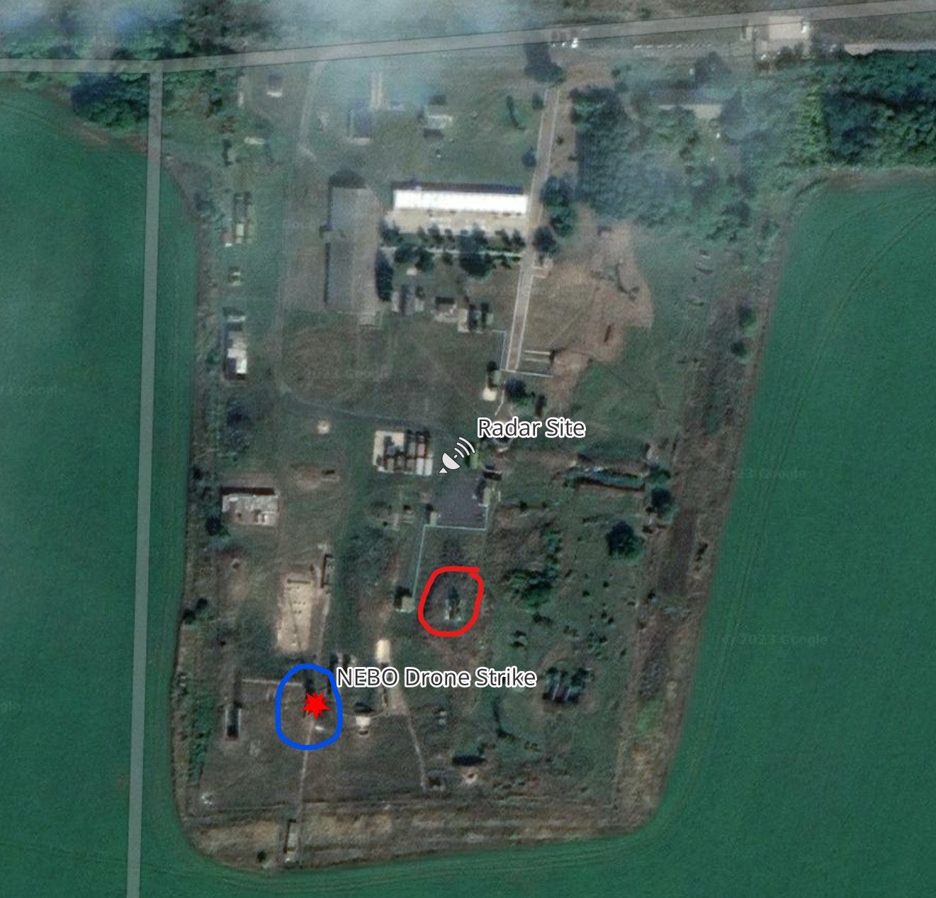
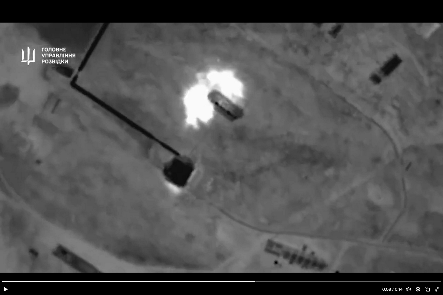
Looks like this radar site near Kursk got hit a second time by drone drop. NEBO-U VHF Early Warning Radar 55Zh6U and probably a GAMMA-S1 64L6 (Not super familiar with the GAMMA-S1 were hit.
This site was hit once around 2023-09-30 see next post in thread.
Location: 52.1065343,35.0586229
Video Link https://x.com/WarVehicle/status/1727003214661460231?s=20


