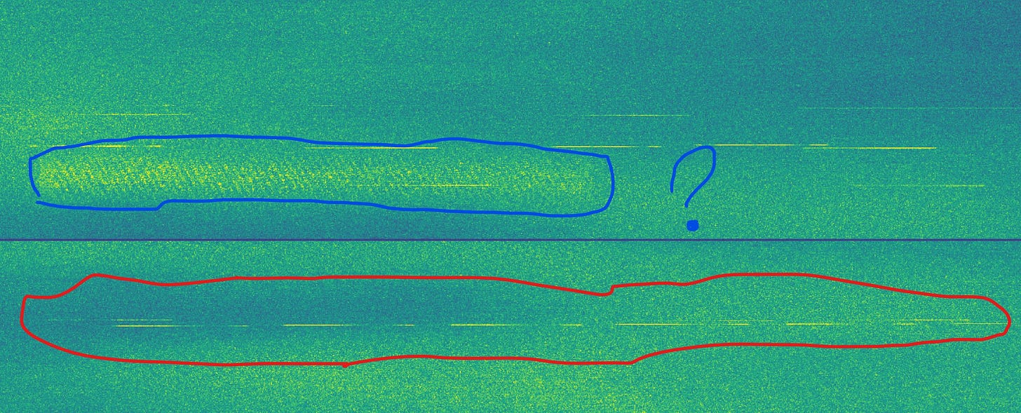
Strong C-Band 5.405MHz +- 100MHz emissions from Volgograd Oblast, Russia 2023-09-09 03:23:06 to 03:23:31 UTC. Most of the radar emission we have seen on Sentinel-1 appear to originate from BUK air defense systems. The 9S18 Snow Drift, 9S36 radar or the radar built in to the TELAR. The source of these emissions remains unknown. We have also noted large amounts of interference from the Voronezh RCS test range and The Rostov-on-Don Institute of Radio Research! But it tends to be less pulse like without obvious pulse compression unlike these emissions. Source: European Space Agency / Modified Copernicus Sentinel data 2023 Site 1 top image: Near Frolovo Фролово, Volgograd Oblast, Russia 49.718611, 43.768611 Site 2 bottom image: Near Ryabovskii Рябовский, Volgograd Oblast, Russia 49.946927, 41.569437 Thanks for the heads up from @Rb3qzWR5AK5nooA
Raw I/Q that was used to make the above image. You can see the radar pulses (red outline) and something else (blue outline) possibly data or a very high PRF radar mode.
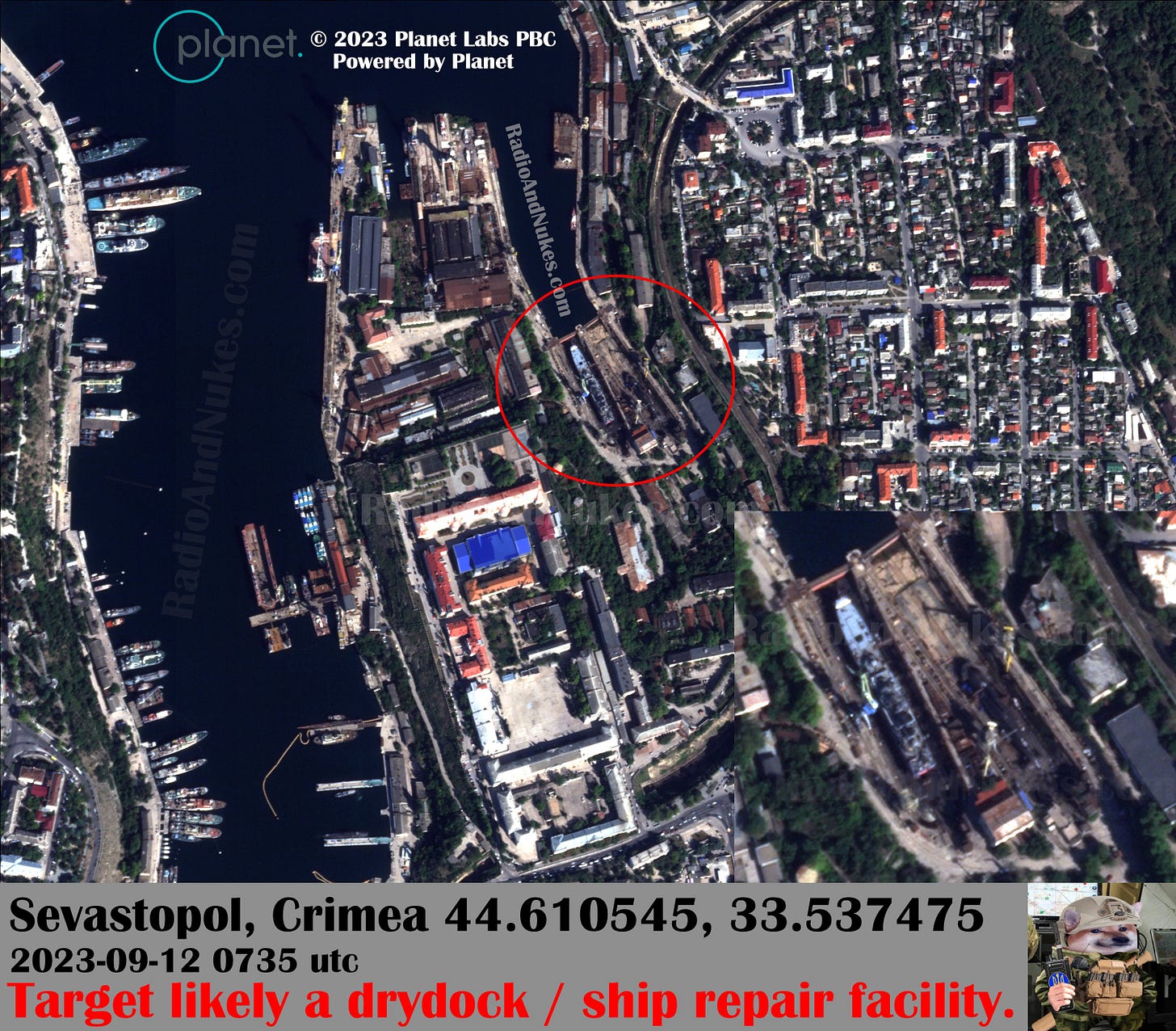
Here is a satellite image of the vessels in the dry dock that was struck in Sevastopol. It appears to be a Ropucha-class Project 775 landing ship and a Kilo class submarine. Image date / time: 2023-09-12 0735 UTC
Image source: © 2023 Planet Labs PBC Powered by planet. 44.610545, 33.537475 Thanks for the help:
@HelloMrBond @exit266 @Misfit4Ukr68491 @Mattl8241
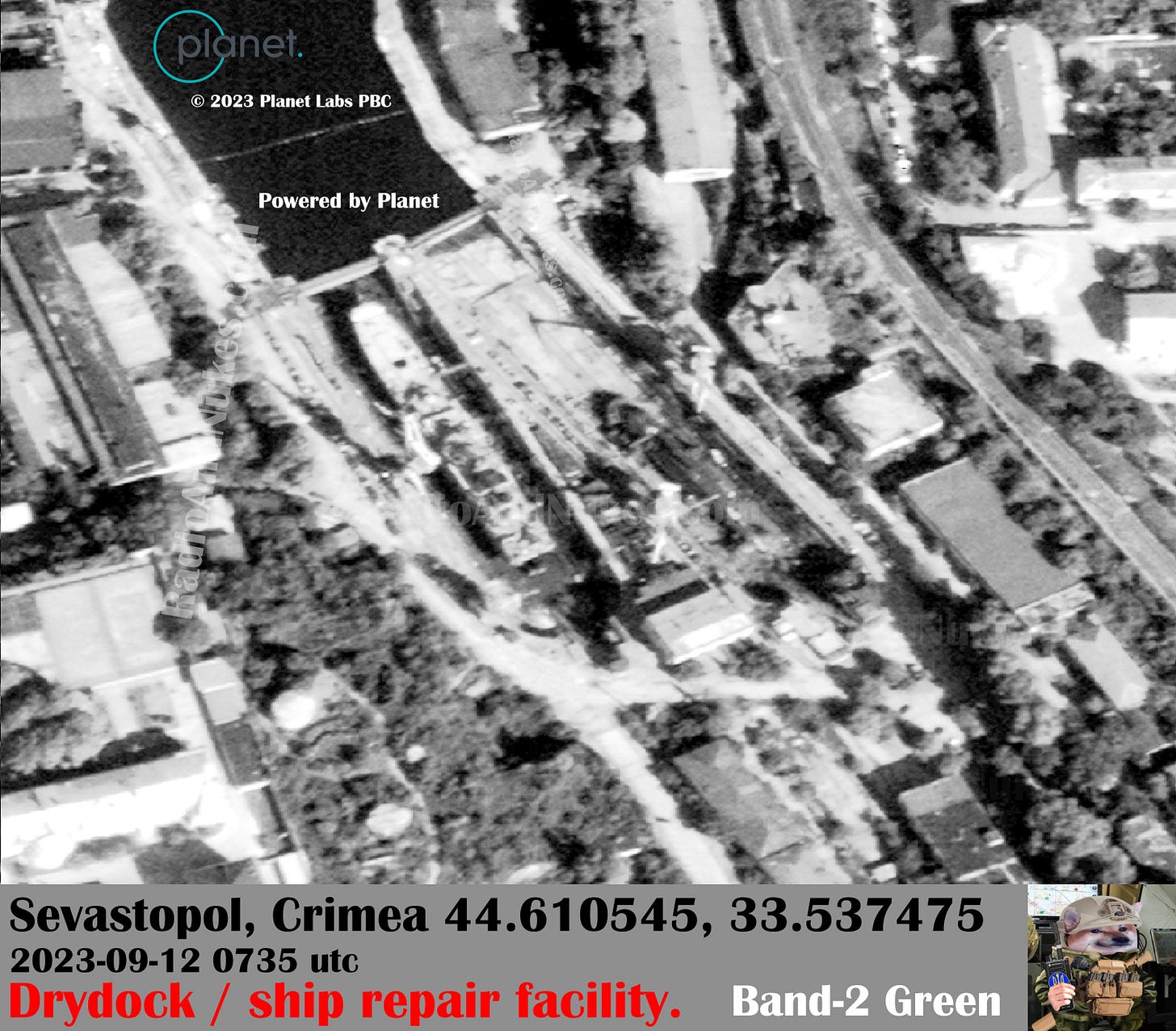
Enhanced close up of the #Sevastopol drydock using only Planet SkySat Band-2 Green 515-595nm.
Image source: © 2023 Planet Labs PBC / Powered by Planet. Image time / date: 2023-09-12 0735 UTC
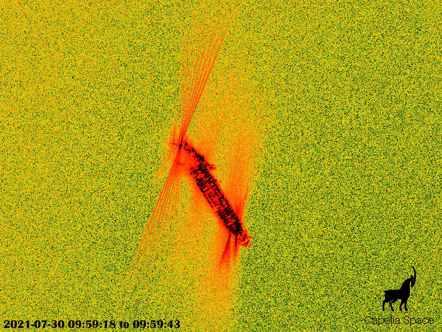
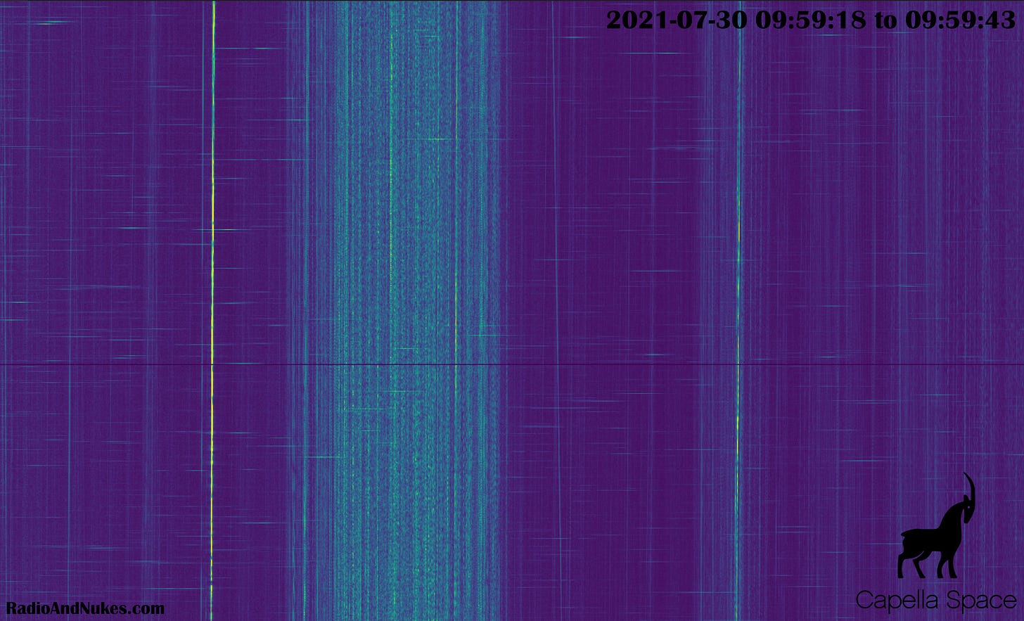
We had a go at processing CPHD files from @capellaspace to see if the radar emissions were visible in a FFT of the Complex Phase History Data, sure enough! It looks like X-Band marine radar pulses and some non pulsed emitters of some kind, I would guess microwave datalinks. We need to put some more work into this but it's really cool to see these radar waveforms. Next step is to verify this 110% without a doubt, but it's looking possible to recover useful emitter information from CPHD SAR data.
Image source: Capella Space opendata X-band (9.4 – 9.9 GHz)
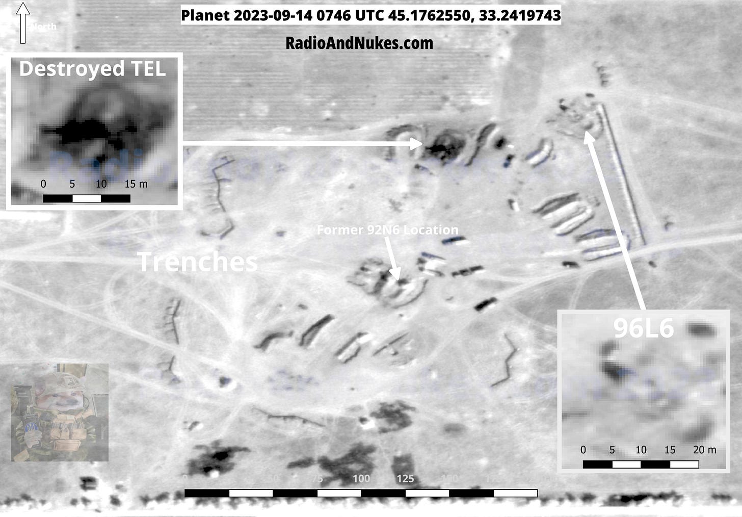
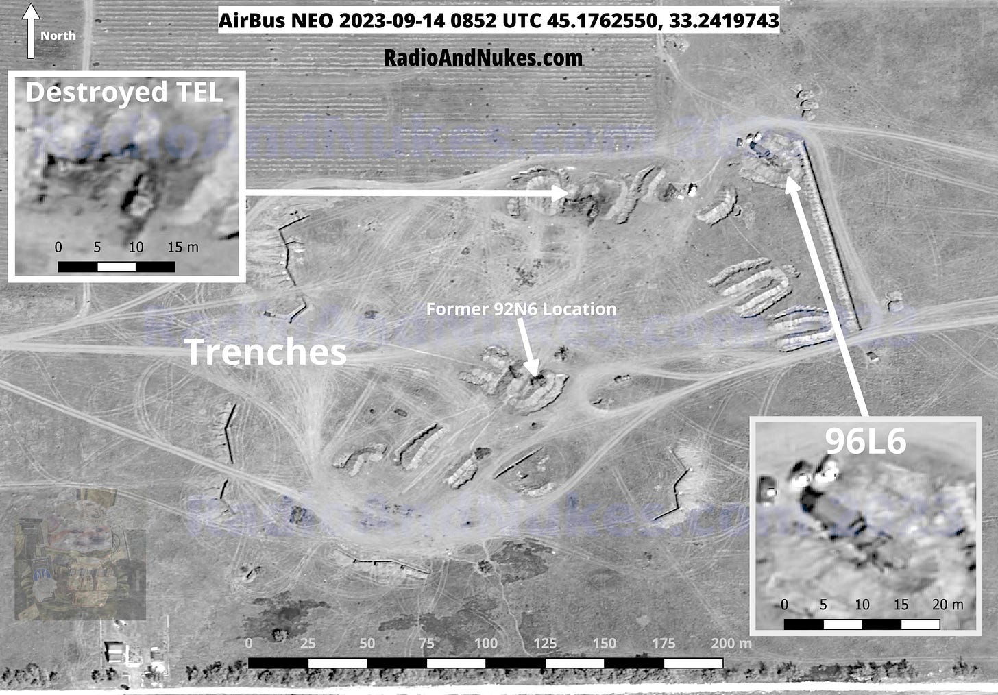
S-3/400 site BDA near Yevpatoriya Crimea, Ukraine 2023-09-14. Russian Air Defense forces have pulled back most of this S-3/400 launch site. The images are roughly one hour apart with the Planet image at 0746 UTC and the AirBus NEO image 0852 UTC. Note several vehicles have been moved from the site in one hour!!! We will need to revisit this location to verify if this is a temporary measure.
Image 1: © 2023 Planet Labs PBC 9/2023 Powered By Planet.
Image 2: © Airbus DS 2023 Pléiades Neo Location: 45.1762550, 33.2419743
This area is 1165m NW of the previous site. It appears to also be a S-3/400 site. That maybe a 92N6 radar in the central berm 50/50. It appears the vehicles in the square are transporting missile tubes.
© Airbus DS 2023 Pléiades Neo 2023-09-14 0852 UTC 45.1810881, 33.2293284
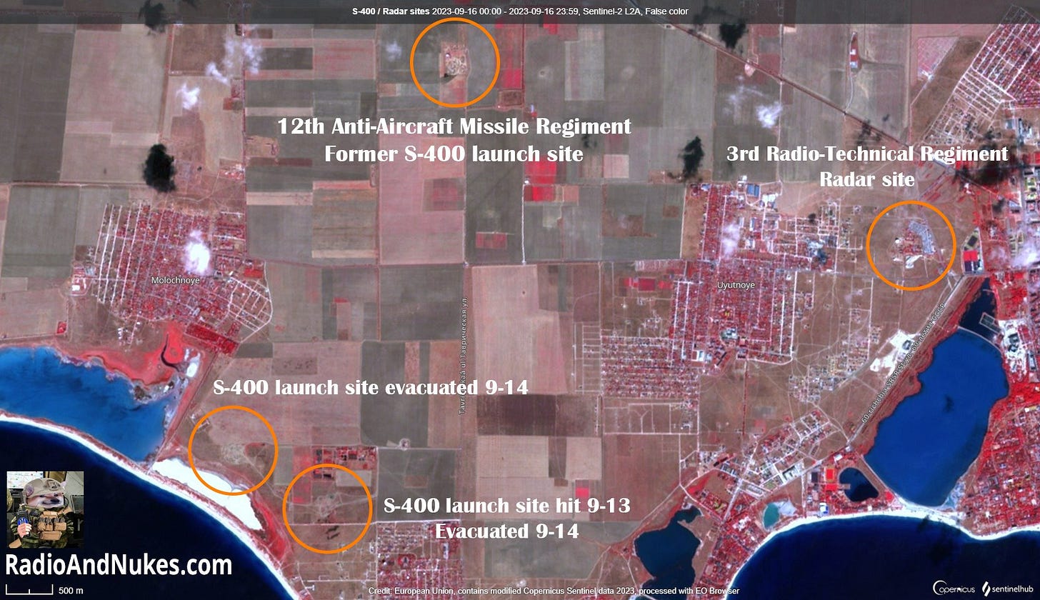
Overview of Russian Air Defense sites around Yevpatoriya Crimea, Ukraine.
Imagery: Sentinel Hub
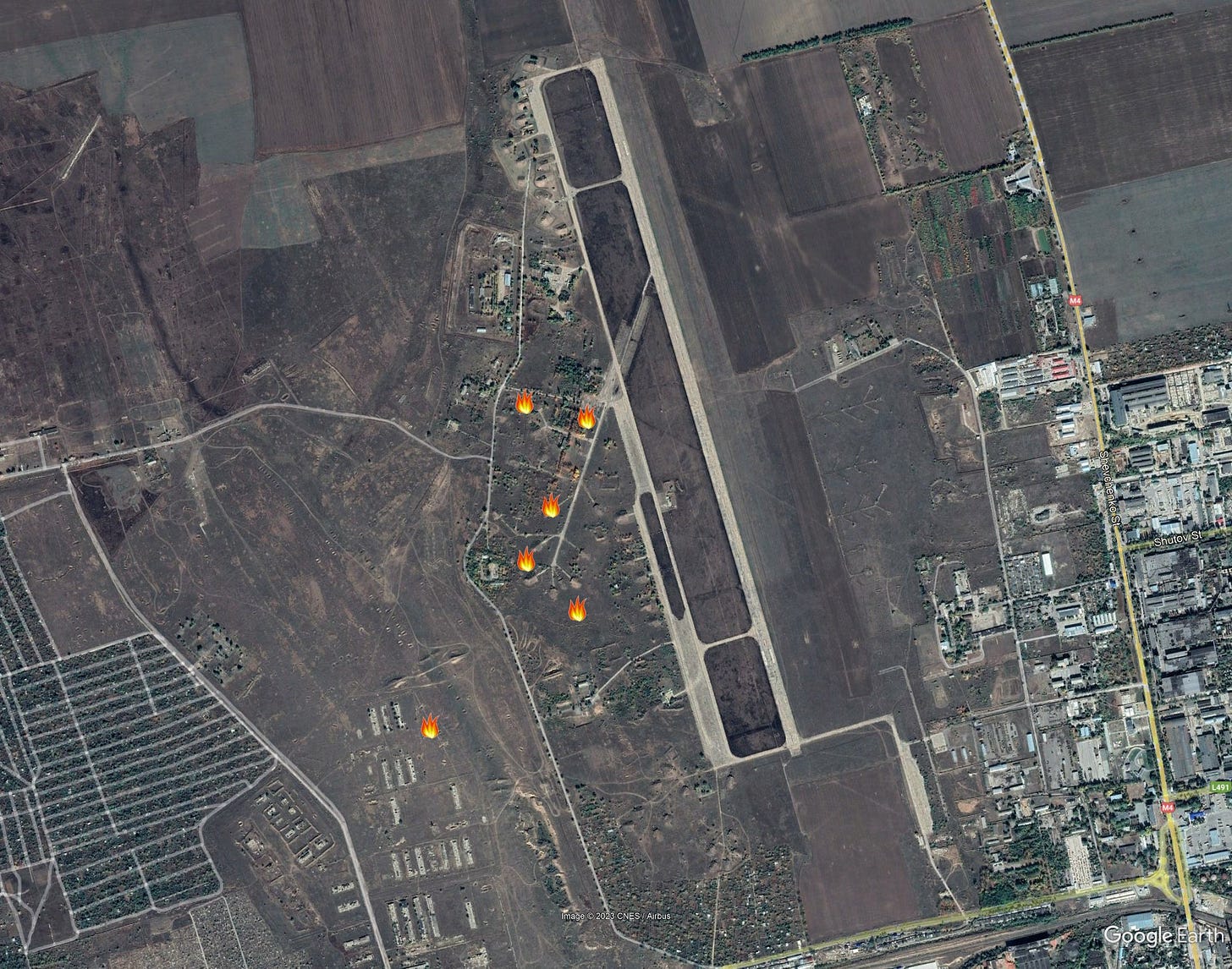
I suspect this is nothing, but it's worth posting so others don't go down the rabbit hole. FIRMS showed several fire spots in the military training area just north of Tiraspol, Transnistria. The Sentinel-2 pass earlier today revealed large burn scars in the training area extending into the old Soviet airbase. It's hard to say if this was a controlled burn or a fire caused by training activates.
Image 1: Modified Copernicus Sentinel data 2023/Sentinel Hub / Russian Military Index 1.45
Image 2: Google Earth Pro / NASA FIRMS
It appears that the Protected Command Post of the Black Sea Fleet may have been hit. Nothing can be seen on this 3 meter Planet Scope imagery. Looking for better imagery now! If this was a bunker bust it's likely we will need high res imagery to see the entry point. I will post updates as new info comes in.
Imagery: © 2023 Planet Labs PBC / Powered By Planet.
After some enhancement it appears likely this 4 meter circle is the impact point of the missile that struck the Protected Command Post of the Black Sea Fleet on 9-20-2023. The entire southern wing of this building complex was destroyed in the strike. We do not yet know the status of the underground complex.
Image 2, shows the building pre strike. Lat/Lon: 44.7145006, 33.7047871 Time/Date: 2023-09-21 0521 UTC
Image 1: © 2023 Planet Labs PBC / Powered By Planet.
Image 2: Google Earth Pro
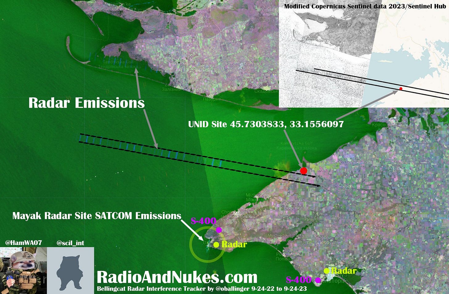
We found something! This site is on the northwest Crimean coast near Kotovs'ke, and may have been emitting in the C-Band 5.405GHz +- 100MHz on and off since May 2023. @scil_int located this using Sentinel-2 we then acquired an older Airbus Neo image of the site. I am not 100% sure this is the emitter source, it could be high power radar emissions from the well-known Mayak radar site. The systems likely to show up on Sentinel-1 in the C-Band are BUK Snow Drift radar 9S18 and the 96L6 radar of the S-400 family.
Image 1: © Bellingcat Radar Interference Tracker by @oballinger 9-24-22 to 9-24-23 / Sentinel-1
Image 2: © Airbus DS 2023 Pléiades Neo 5-24-2023 45.7303833, 33.1556097
Image 3: © Airbus DS 2023 Pléiades Neo 5-24-2023 45.7303833, 33.1556097
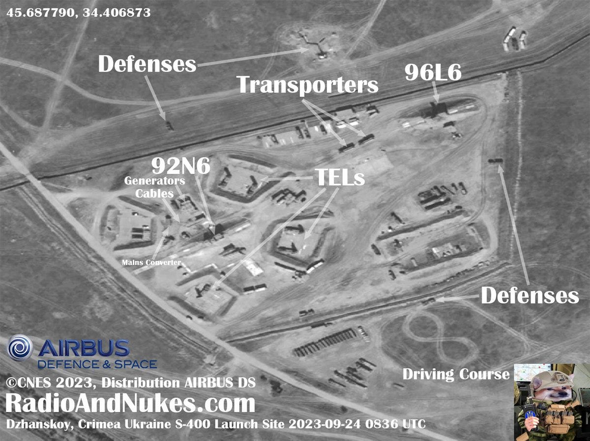
Dzhankoy Crimea S-400 Launch Site 2023-09-24 0836UTC. The S-400 site is still quite active with both a 92N6 engagement radar and a 96L6 acquisition radar present and on site. 5 TELs can be seen setup and ready to fire 48N6 missiles. We are still assessing the reported strike near this site. A large burn scar exists just to the north of the AD area. I have decided to wait for more imagery regarding the attack as we can not identify what if anything was hit.
Imagery: 2023 CNES Distribution Airbus DS
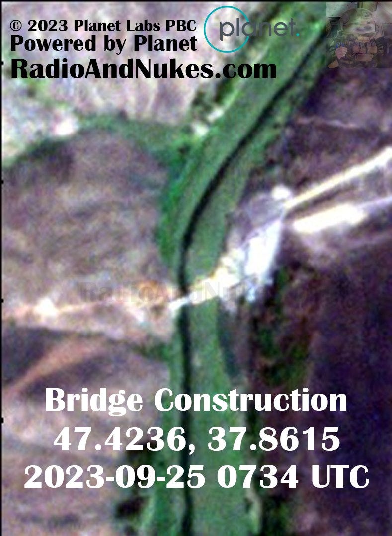
New bridge under construction, likely a new railroad as mentioned below. Just south of Staromar'ivka Старомар'ївка, Donetsk Oblast Location: 47.4236, 37.8615 Imagery: © 2023 Planet Labs PBC Time: 2023-09-25 0734 UTC
Composite image of 5.405GHz +- 100MHz SATCOM emissions near the Mayak, Crimea Ukraine. From 3-27 to 9-25-2023. 45.347567, 32.504132 After extensive comparisons these emissions are highly likely to be SATCOM (satellite communications) emissions vs radar emissions. We have noted these from three sites. Mayak, near Luhansk and Moscow over the last 6 months. They all appear to be associated with air defense units.
I have no idea what happened at Dzhankoy Air Base Crimea, Ukraine between 2023-09-18 and 2023-09-24! Something new was built in the area of the grassfire, which is all we can conclude from this imagery. 1: Burn scar / grass fire 2: S-400 site 3: Vehicles leaving the base
Imagery: ©CNES 2023, Distribution Airbus DS Location: 45.687790, 34.406873
Image 1 (before): 2023-09-18 0832 UTC
Image 2 (after): 2023-09-24 0836 UTC
We had a look at this possible Russian air defense site 1km NE of Belbek Air Base Crimea. This site appears to be an old pre-prepared AD site with some recent activity. It is possible the S-400 TELs evacuated from Yevpatoriya have been / will be moved to this site, we don’t have enough information to confirm yet. We will be keeping an eye on this site going forward.
Imagery: ©CNES 2023, Distribution AIRBUSDS Date / Time: 2023-09-25 0830 UTC 44.70580, 33.59878
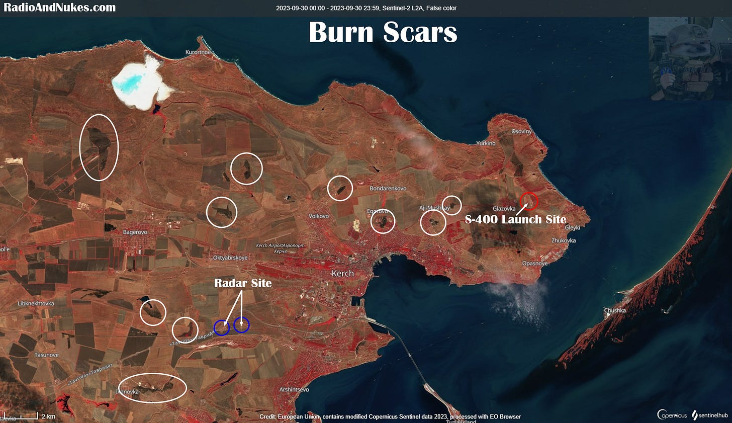
Quite a few burn scars around the Kerch peninsula as of 2023-09-30. It does not appear the Kerch S-400 site or the Kerch Radar Site were damaged. However it's difficult to say for certain using low resolution imagery.
Imagery: Modified Copernicus Sentinel data 2023/Sentinel Hub Date/Time: 2023-09-30 0957 UTC Location: 45.36227, 36.35965 Kerch Crimea, Ukraine


